
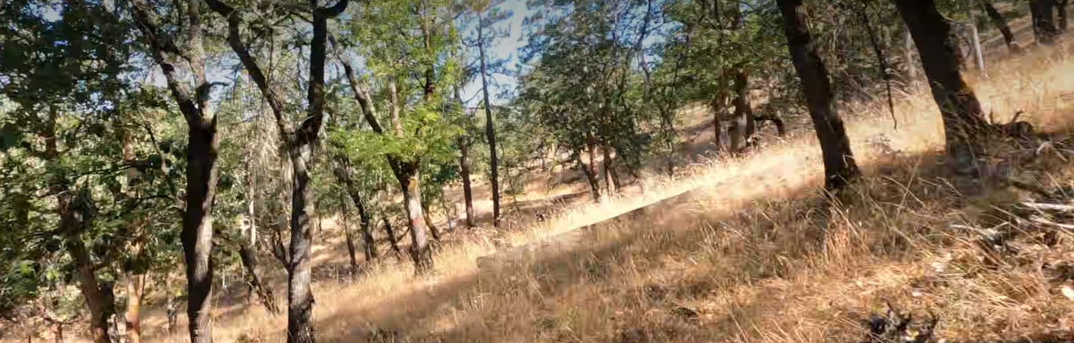
Lithia Park East Hillside Mountain Bike Trails
Proposal to add beginner-level bicycle trails flowing to-and-from downtown Ashland.
We love Lithia Park, and believe it to be one of the finest assets in Ashland - the crown jewel if you will.
As the proposed trail area is well outside what many users consider “Lithia Park”, and the main Lithia Park features a two-way, heavily trafficked paved road, a bandshell featuring live music, pickleball courts, playgrounds, swimming hole, and volleyball courts, we consider it to be a well-developed public park catering to multiple interests.
The jewel of Lithia Park has many facets. We believe this proposal is set to make it shine even brighter.
The project aims to construct a safe, beginner-friendly, and adaptive-accessible link between downtown Ashland and the existing mountain bike trails in the Ashland Watershed.
At a Glance
Location: Glenview Hillside (connecting the Glenview Street quarry parking area to Pioneer Street)
Trail Length: ~1 mile total (~0.5 mile downhill trail / ~0.5 mile uphill trail)
No new funds required: estimated ~$30,000 (funded via the existing APRC CIP trail budget)
Target Audience: Beginners, adaptive riders, families, and riders seeking a car-free link to downtown
Separates Trail Groups: retains existing mapped hiker-only trails. Continues proven watershed trail formula of separating user groups in areas close to town.
Key Highlights & Benefits
Ashland’s First True Beginner & Adaptive Trail: Features low gradients (4% or less throughout) and wide, machine-built tread (3–4 feet) to accommodate adaptive bikes and novice riders.
Designed for Safety: Features high visibility at intersections with existing pedestrian trails, featuring short uphill sections before intersections to naturally check downhill rider speed.
Eliminates Road Hazards: Bypasses narrow roads with blind corners and heavy vehicular traffic (including the Lithia Park "gauntlet") to create a safe, car-free connection for cyclists entering and exiting downtown.
Economic Boost for Local Businesses: Directs cycling traffic straight to downtown shops, restaurants, and parking, allowing local and visiting riders to access pre- and post-ride services.
Wildfire & Safety Surveillance: Increases regular usage on a hillside prone to illegal camping, providing more visibility and early detection for potential fire hazards.
Erosion & Trail Management: Reduces unsanctioned "volunteer" trails and cyclists on existing paths by providing a dedicated, professionally engineered route.
1. Trail Specifications & Design
Downhill Trail: 36-48” wide machine-built by a professional contractor; smooth, low-angle, flowing singletrack with undulating features (rollers) that allow riders to slow down naturally without heavy braking.
Uphill Trail: Hand-built, narrower singletrack designed with a steady, manageable climbing grade running in the opposite direction.
Crossings & Visibility: Designed with high visibility at intersections with existing pedestrian trails, featuring short uphill sections before intersections to naturally check downhill rider speed.
2. Location & Connectivity
Upper Terminus: Quarry parking area on Glenview Street (connecting to BTI, Jabberwocky, Snark, and Bandersnatch trails).
Lower Terminus: Dirt section of Pioneer Street, leading riders directly toward downtown and the Hargadine paid parking structure.
3. Construction Plan & Budget
Estimated Cost: Approximately $30,000 based on comparable projects (e.g., Wasabi Trail).
Funding Source: Existing APRC Capital Improvement Project (CIP) trail budget.
Timeline: Professional machine build anticipated to take 2–3 weeks, followed by volunteer finishing work.
4. Maintenance & Stewardship
Lead Volunteer Groups: RVMBA, Ashland Devo, and local trail stewardship organizations.
Schedule: Two dedicated volunteer workdays per year during the rainy season (November–March).
Long-Term Plan: Periodic machine cleanup/reset every 3 to 5 years, subject to budget and usage needs.
Environmental & Community Impact
Flora & Fauna: Low footprint; construction avoids major trees (>10" DBH) and focuses on clearing brush. Minimal impact relative to existing human activity in the adjacent Lithia Park corridor. Native plant locations have been identified and will be avoided.
Traffic & Parking: Eases vehicle and parking congestion at upper watershed trailheads by enabling riders to pedal directly from downtown or their homes.
Fire Safety: Situated primarily in Fire Unit UL-5 (rated Extreme). Increases community presence on the hillside and breaks up fuel continuity.
Frequently Asked Questions
-
On the City of Ashland’s Trail Page or a direct link to the proposal or scroll down the page for the links
-
According to the fire chief, more traffic in the area reduces unsanctioned camping. Additional trails act as fire lines. Area already has eight pedestrian trails. Bicyclists and pedestrians mitigate fire danger by their presence and reporting illegal camping.
-
The proposal specifically addresses this, and with careful building techniques, no harm will come.
Additionally, the proposal has been vetted by the Forestlands Management Advisory Committee.
-
The preferred route to access downtown after-ride restaurants (due to Winburn’s traffic problems) is via Fork street which routes cyclists directly past OSF, but at a higher rate of speed due to Fork street’s sharper grade.
We estimate similar traffic levels but at lower speeds. -
Noting that Glenview road (with cars driving by) is also in the vicinity, this seems to be a specious and hyperbolic argument, but let’s address it:
1. Beauty: there are already 8 trails crisscrossing the Glenview hillside. Considering that care has been taken to separate the trail users and minimize interactions, we don’t feel a significant reduction in beauty will occur.
2. Tranquility: since uphill mountain biking is roughly the same noise level as hiking or trail running, we can focus on the downhill. The trail will be approximately 60% closer to the highest trail on the mapped Glenview trails than the auto road, and we anticipate cyclists will take this route. However, the grade is low, and given ample consideration in the proposal to have all trail intersections marked and trail speed slowed, yes, it may reduce the tranquility index. We expect that were this to be another hiking trail, it would also reduce the tranquility due to other users traversing the area. -
As this area is well outside what most users consider “Lithia Park”, and the main Lithia Park features a two-way, heavily trafficked paved road, a bandshell featuring live music, pickleball courts, playgrounds, swimming hole, volleyball courts, we consider it to be a well-developed public park catering to multiple interests. A jewel has many facets. We believe this proposal is set to make it shine even brighter.
-
Ashland has many hiking and biking trails. It doesn’t have a single beginner level trails. These trails will provide that missing link.
We also feel, that were the situation reversed (all Glenview trails were bike-only) that hikers would be asking why they were barred from the most walkable/ridable singletrack trails in the City. Viewed with that lens, a request to retain all existing mapped trails, and adding a hiking loop seems quite reasonable.